
Greetings Blog Fans and welcome back. After a one-year break, we reinstated our tradition of traveling at Thanksgiving with our third trip to Sedona. We love the weather and miles of easily accessible hiking trails. Once again, it did not disappoint!
We had to add a slight wrinkle to the plans as Nicole’s college schedule didn’t allow her to take the whole week off so she joined us on Wednesday — so glad she did!
Most days were spent hiking (Alex and I clocked 45 miles for the week) but we also visited the small town of Jerome on the way in and took a trip up to Flagstaff for a college visit. But enough of the preamble — let’s get to the photos!
Saturday — Jerome
From Wikipedia: Jerome is a town in the Black Hills of Yavapai County in the U.S. state of Arizona. Founded in the late 19th century on Cleopatra Hill overlooking the Verde Valley, it is more than 5,000 feet (1,500 m) above sea level. It is about 100 miles (160 km) north of Phoenix along State Route 89A between Sedona and Prescott. Supported in its heyday by rich copper mines, it was home to more than 10,000 people in the 1920s. As of the 2010 census, its population was 444.
Today, Jerome is a “ghost town” with various tourist shops, museums and art galleries. We enjoyed our quick visit.
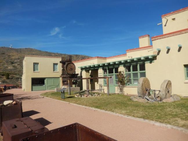
Our first stop was to the Douglas Mansion at the Jerome State Park. We saw a video about the history of the town and toured the exhibits (inside and out). The shot above is of the back side of the house.
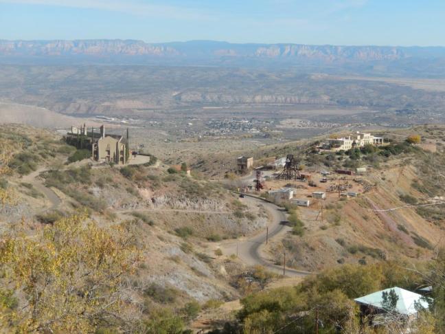
From the town of Jerome looking back at the mansion and grounds. The Douglas family took over the mines in the early 20th century.

This is from the mansion looking back at the hillside town of Jerome. After the State Park, we did have a walk around town, took in some shops and galleries and enjoyed a late lunch before heading to Sedona to settle in for the week.
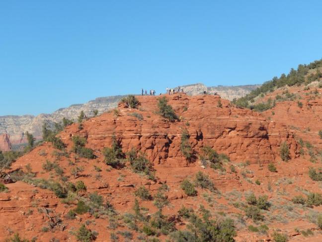
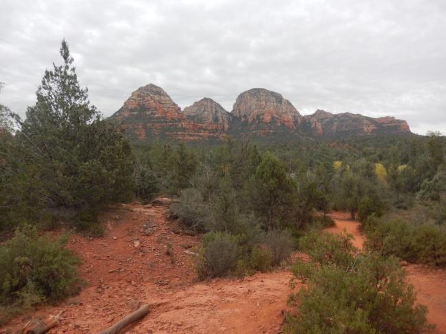
Sunday — Sugar Loaf and Chimney Rock

We tried some new hikes early in the week before going back to some favorites with Nicole. Our first hike was a nice warm up that combined the Sugarloaf and Thunder Mountain (Chimney Rock) trails. We started at the Sugarloaf trailhead.

Fairly flat at 400′ min/max; 7.5 miles in 4:35 (3:35 moving) according to my trusty GPS.
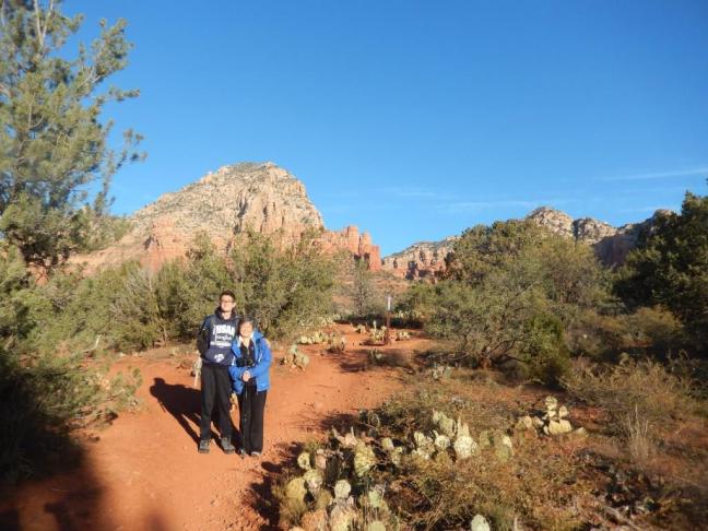


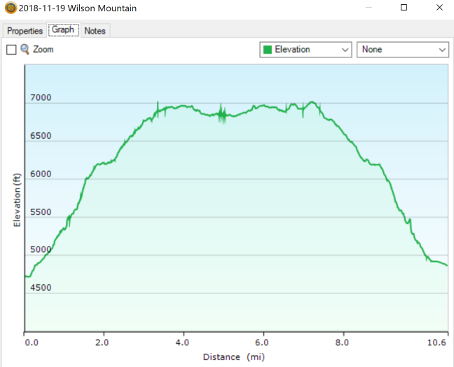
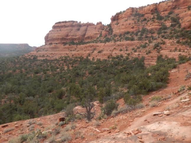
Monday — North Wilson Mountain
After that nice warm up on Sunday, we were ready for another new hike. North Wilson Mountain was a challenge. Some of the reviews almost scared us off but we decided to give it a try. Glad we did but it did wear us out!

The trail for North Wilson Mountain starts from the Encinoso picnic area off 89A about 3 miles north of Uptown. There’s a pretty significant climb the first few miles then a relatively flat section at ‘First Bench’ (don’t be fooled, there’s no bench it’s just the name of the area) followed by another climb. After the second climb there are viewpoints in either direction though one is a bit farther away. You certainly feel like you’ve accomplished something after this hike!

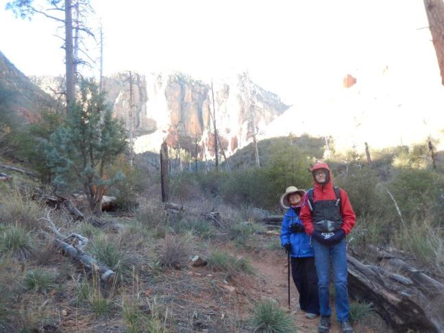


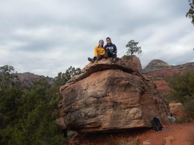
After a relaxing lunch (nap?) we headed back to the Sedona viewpoint. There was a slight climb involved so Kuk opted out (to hang out with the spider I guess).


Tuesday — Northern Arizona University
We took a break from hiking and drove up to Flagstaff (about 45 minutes north) for a formal visit to Northern Arizona University. Alex is a junior and I considered this an opportunity for a “practice” college visit. Though he went on a couple with Nicole this really helped him calibrate on what college looks like.
Most of you know that Alex is a decent runner and is considering running in college. You might not know that NAU is the 3-time defending NCAA (Div I) men’s Cross Country champion. (Training at 7000′ helps but they obviously drawn some good coaches and runners as well). Professional runner and fellow North Central HS graduate Futsum Zeinasellassie went there so that’s an interesting connection as well (though schedules didn’t align for us to meet).
The campus is in a wonderful setting and the 4-season climate and outdoor opportunities are a big draw. We didn’t go in to the tour thinking this would be a “match” but it was a good experience.


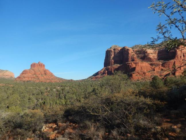
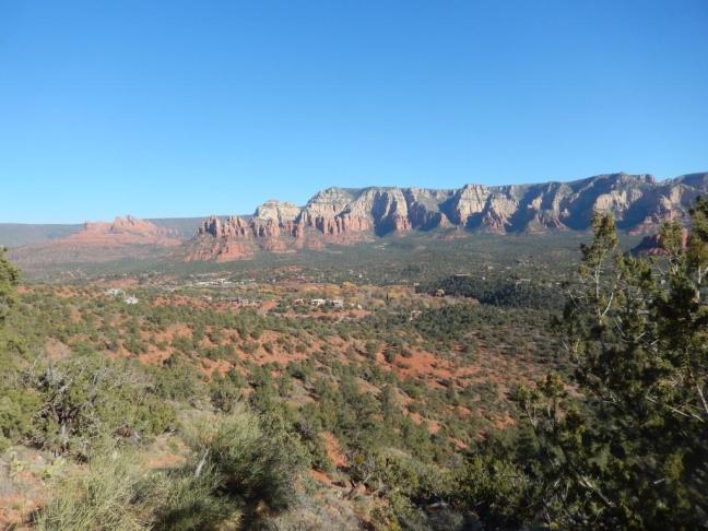
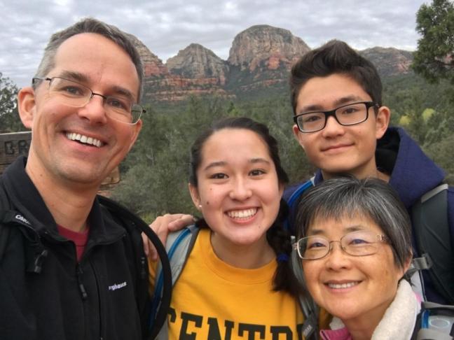
Wednesday — Bell Rock, Nicole!, Airport Loop
Nicole had an early flight to PHX followed by a ride with Arizona Shuttle and was expected around lunch time. Kuk decided to walk around the shops in Uptown while Alex and I hiked around Bell and Courthouse Rocks (in the morning).


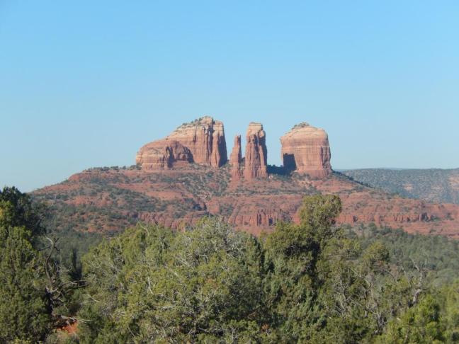
This is a highly recommended hike. Great view/effort ratio. I recommend going around counter-clockwise from the Bell Rock Vista parking area (in the morning at least). This affords great views of Cathedral Rock as you come around. The bit by the road is a more crowded (with mountain bikers too) and we just motor through that stretch at the end.


After some extra excitement of a road closure and Nicole’s eventual arrival, we all met up for lunch back at the condo. Next up was another repeat (from 2014), the Airport Loop.
It too is a nice hike with some good panoramic views of Sedona (5.1 miles in 2:54)


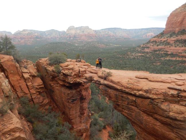
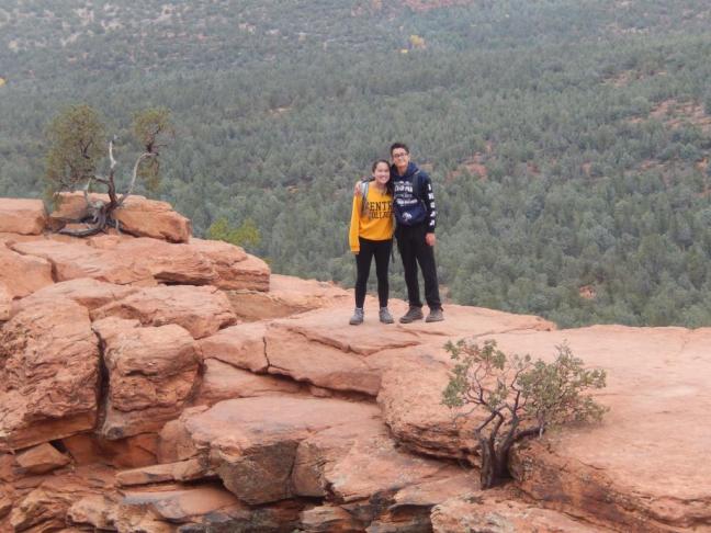
Thursday — Devil’s Bridge and Mescal Trail
There was some rain in the forecast for Thanksgiving so we decided to do 2 medium trails instead of one long one. We got some clouds in the morning but the rain didn’t come until overnight in the end. It’s odd not to see the blue skies in the photos! We did this combo back in 2014 but we switched the order to make sure we weren’t too tired for Devil’s Bridge.
We parked off Long Canyon Road to have access to both trails (and we didn’t have a 4×4 anyway to get to the proper Devil’s Bridge trailhead).


We’ve done the Mescal trail all 3 visits. It contains a nice walk around a “cliff” and like most hikes here has some nice views. It wasn’t on my radar on that first trip but we ended up walking with a Sedona hiking group after I contacted the Great Sedona Hikes author with a question!

2016 and 2014 versions below:


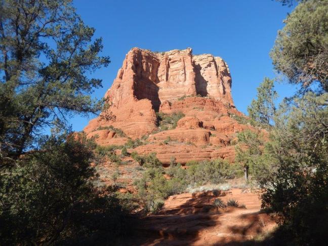
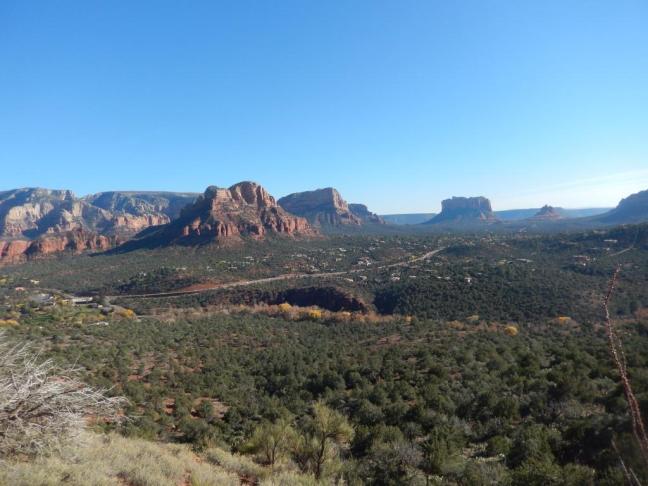
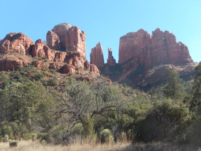
Friday — Cathedral Rock via the Hiline Trail
We saved arguably our favorite trail for last. We parked at the Yavapai Point trailhead and took the Hiline Trail all the way to Baldwin around to the Templeton trail along the creek and around Cathedral Rock and finally back to the start. It’s a pretty long loop. We decided we could probably cut through the east Baldwin trail to shave a little over a mile next time (but that misses out on the rest room!). Refer to the red trail back on the Bell Rock map on Wednesday for the route.


Saturday — Heading Home
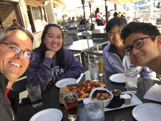
We had a late flight back and could have fit in another hike. Instead, we took it easy, bought some souvenirs and had a late lunch at another favorite: Four Peaks Brewery in Tempe before heading to the airport.
Summary
As you can tell, Sedona is our kind of place. We had another great week and were glad we had the opportunity to do so. It was a bit more hectic for Nicole who also brought a lot of work with her but she approved in the end so we’ll probably travel again next year. I expect to be back in 2 years again when the timeshare points roll around again …
